
There are a few ways to get to the trails to hike to Lago di Sorapis but the following guide is by public transport with start and end point being Cortina D’Ampezzo.
I really enjoyed getting the cable car up from Cortina D’Ampezzo and then taking route 213/216 to the lake as the scenery was more stunning! I would only suggest this route if you are relatively fit as there are very steep inclines and it’s not the easiest route.
Most people take the 215 path there and back from Passo di Croci and I advise you take this if you want an easier route. This is possible by public transport by taking the 030 bus to Passo di Croci from Cortina d’Ampezzo.
Faloria Cable Car – Path 213 then Path 216 to Lago di Sorapis
Total distance covered = 14km
Total time = approx. 4 hours including breaks
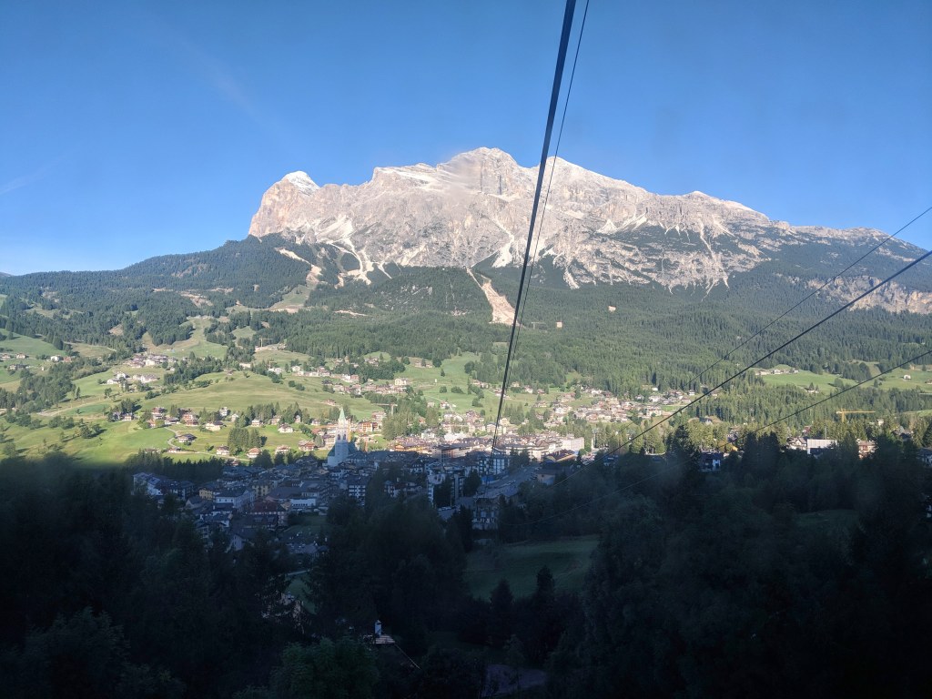
I walked to the Faloria cable car then caught it to the top. From here you walk up paths 213 or 223 then it will meet at 216 where you can easily follow the signs down to Lago di Sorapis.

You need to walk up a relatively steep path to get on to route 213 or 223.


First up hill from the cable car

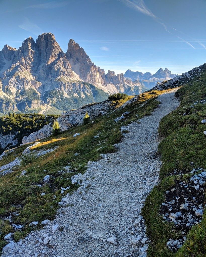
Start of trail
I decided to take 213 but 223 is also an option to Passo Tre Croci.

Y


After walking around 1 hour on path 213, you will see the sign for path 216, so follow that to Lago di Sorapis.
However, a few hundred metres later, you get to a VERY steep rocky uphill part. It was fairly difficult as there are small slippery rocks so you need to be extra careful but also be confident in going up as it’s very steep.
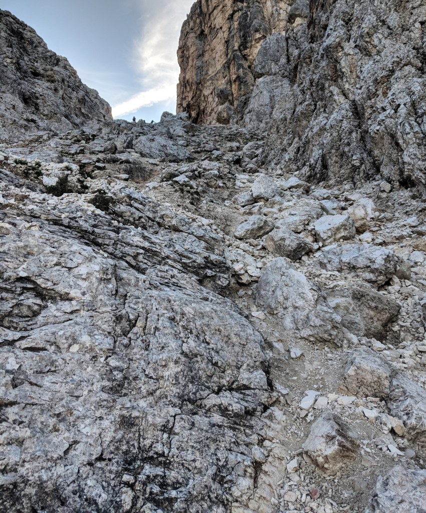
Steep rocky uphill
After this steep uphill part, you will be rewarded with amazing views and it’s downhill for a bit from here.

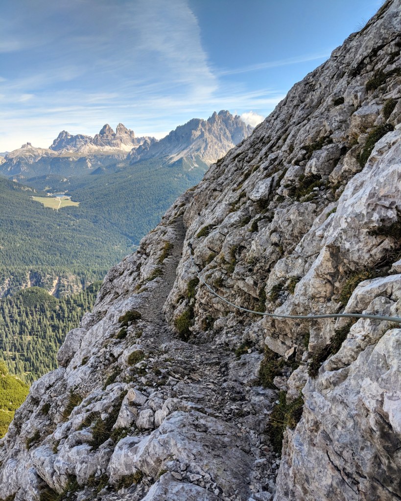
After the steep uphill
There are parts were you want to hold on the wires. It is steep but not as scary as it looks unless you are scared of heights.

From this point, it is pretty much all down hill. You can see Lago di Sorapis from a distance and the scenery changes.


I reached Lago Di Sorapis after 2.5 hours. The lake is stunning with a milky blue colour and the mountains as a backdrop. The walk was around 8.5km in distance. I took photos, had some snacks, relaxed and walked around the lake.

Lago di Sorapis


I took Path 215 back to Passo Tre Croci which is around 6km in distance which took me around an hour. There are ups and downs but more downhills. The scenery was beautiful but still different to what I had taken on the way to Lago di Sorapis.


From Passo Tre Croci, I took the 030 bus back to Cortina d’Ampezzo.
I was using the Moovit app which I thought was super helpful to get correct bus timetables and routes. I also used the Sudtirol Mobil website to find different routes and get around the whole Sudtirol area.
I really enjoyed the 213/216 path as I only saw 5 people in total before reaching the lake. The lake was packed full of people when I reached there so it was nice to have some quiet time by going an alternative route to most people.
Whichever route you take, you will be rewarded with beautiful scenery to and from the lake!

Hello it’s me again Jenny 🙂 I left a comment before I am following your itinerary and I am very interested about your route going to Lake Sorapis. when you said Faloria cable car it’s in Cortina d’ampezzo right?
Hi Jenny – yes it’s in Cortina d’Ampezzo, right in the middle of town.
hi- how did you pay for the bus? Did you have to buy card or ticket before hand or just cash when you get on ?